done_all Download multiple panoramas at once
With the Pro version you can download an unlimited number of panoramas at once.
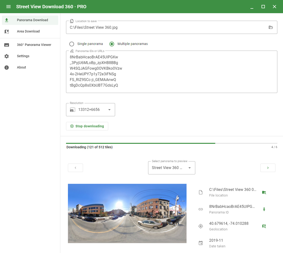
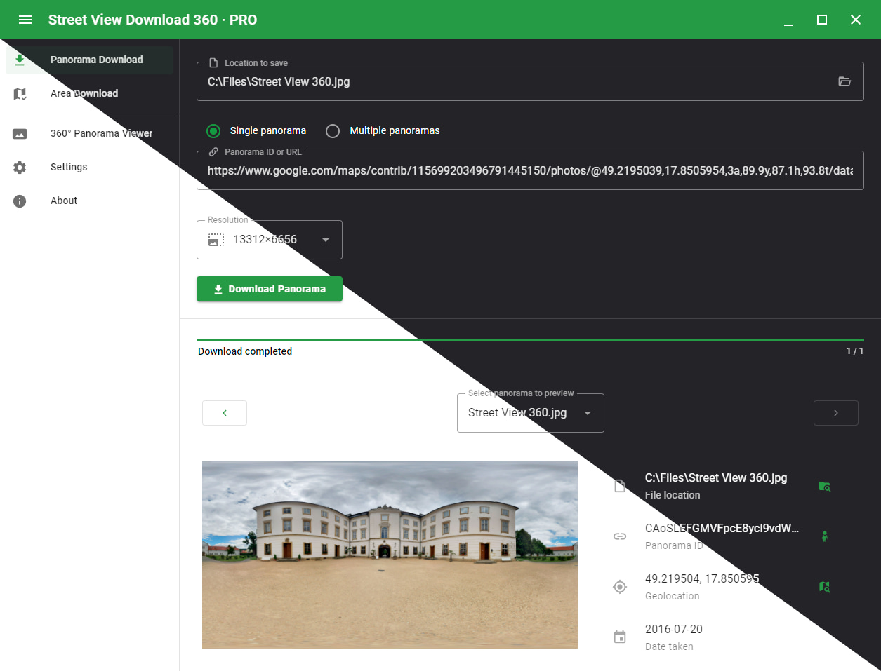
In the free version you can download only one panorama at a time.
map Area download
Download all panoramas within a geographical area.
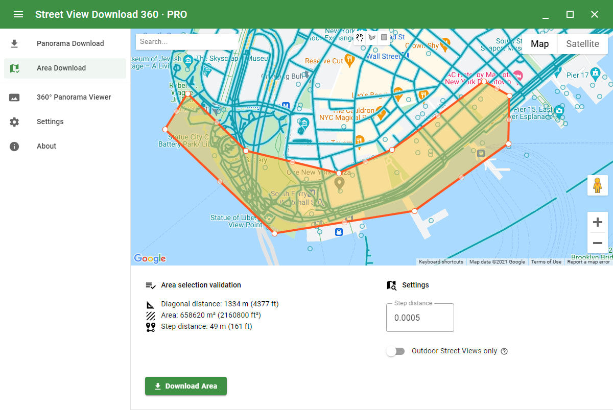
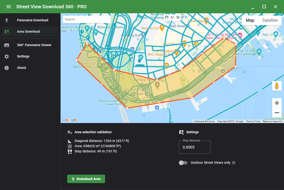
Specify the area to download using a rectangular or polygonal selection on the map.
The step value specifies the size of steps (density) to take when crawling the area.
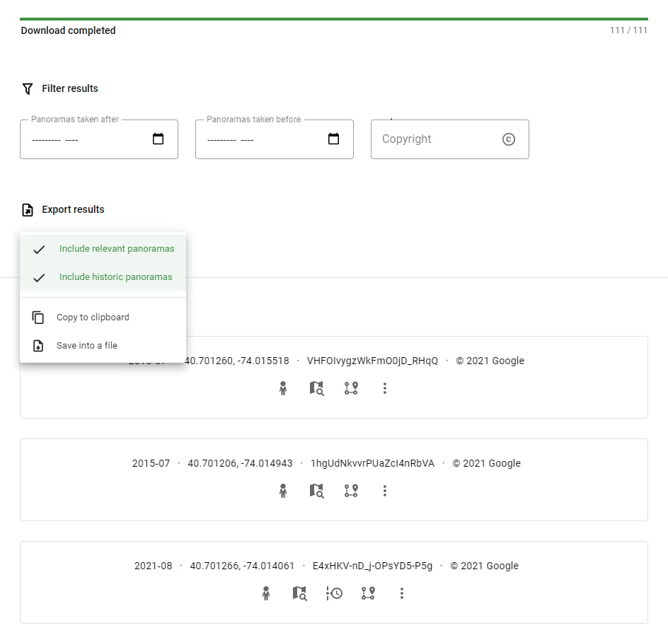
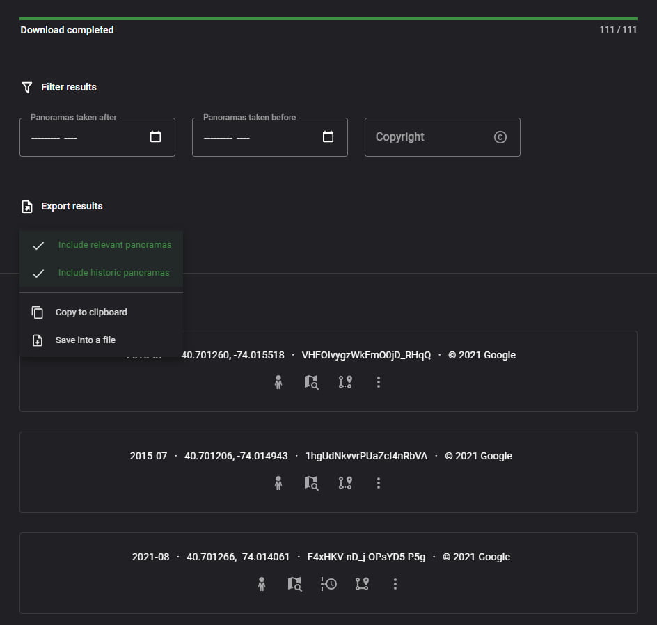
Filter the results and copy the found IDs or export all results as JSON.
The results include:
- Panorama ID
- Coordinates
- Date taken
- Author
- Historical versions
- Relevant panoramas
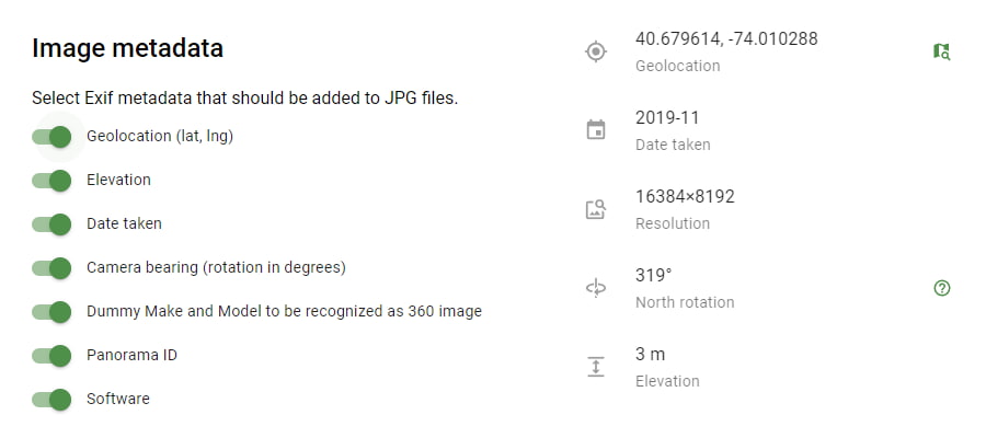
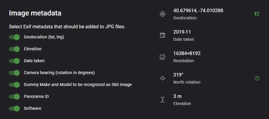
description Exif metadata
Panorama metadata will be automatically added to the image.
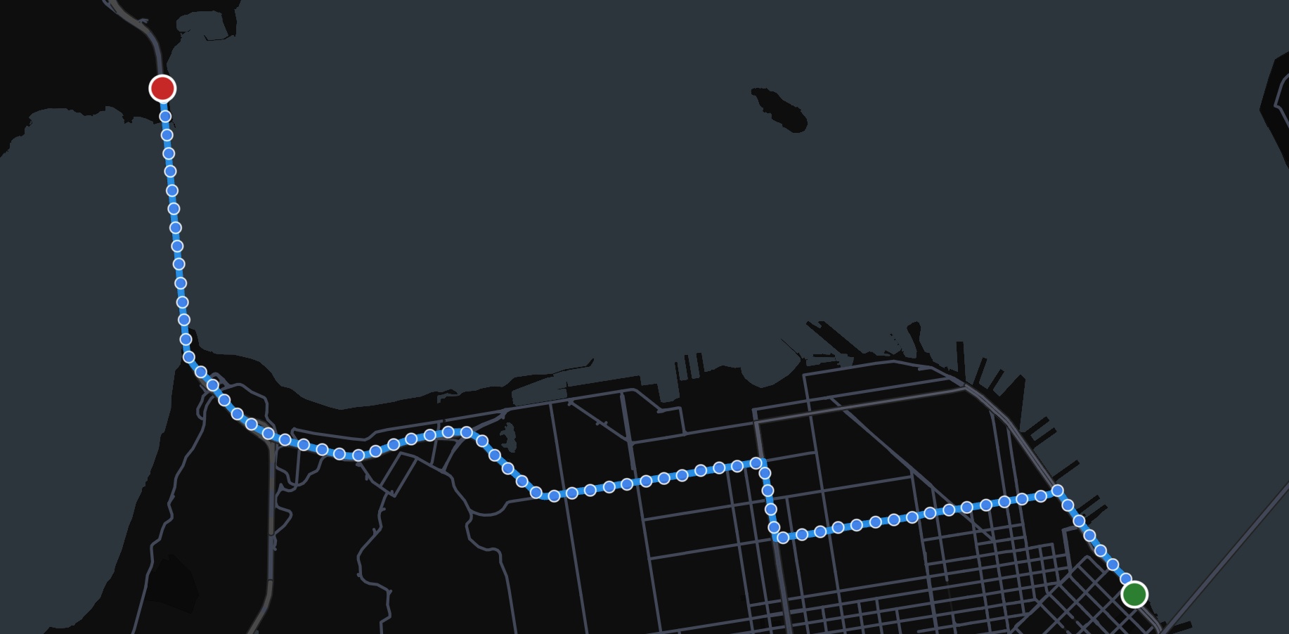
route Download along a path
Specify a start and an end point on a map and download panoramas along the path.
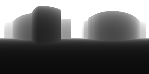
blur_on Depth map export
The downloaded depth map is a grayscale 512×256 image representing the distance to the objects in the panorama.

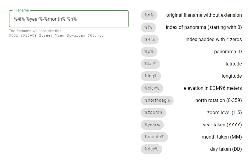
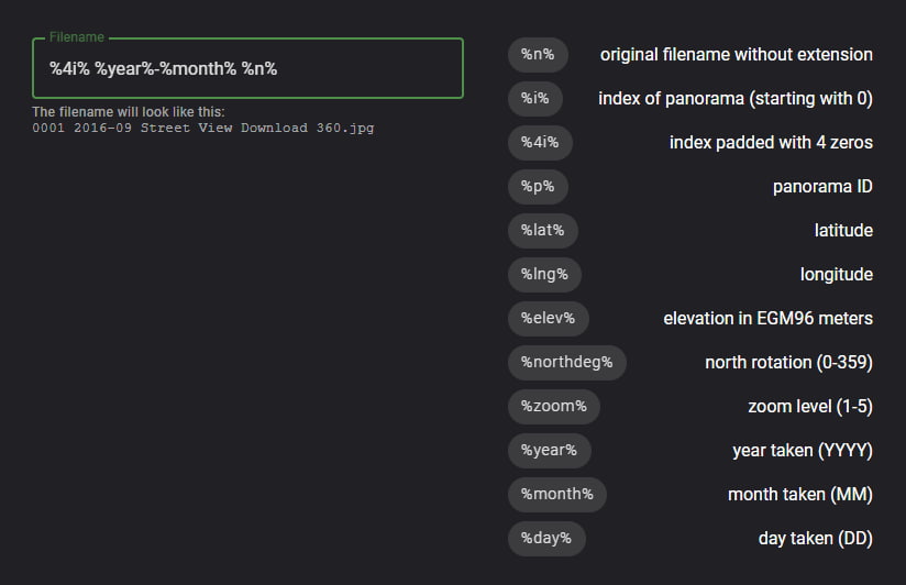
font_download Custom filename
Add variables such as index, lat/lng, or year/month to the filename.
dark_mode Dark theme